Kedarnath Trek
Location: Garhwal Himalayas
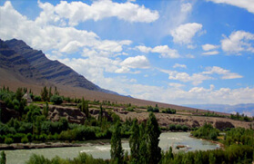
Base: Rishikesh
Duration: 15 Days
Grade: Tough
Best Season: May - June & September - October
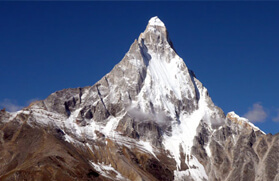
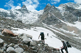
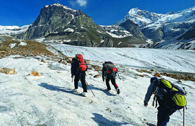
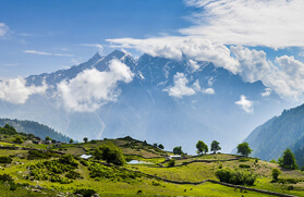
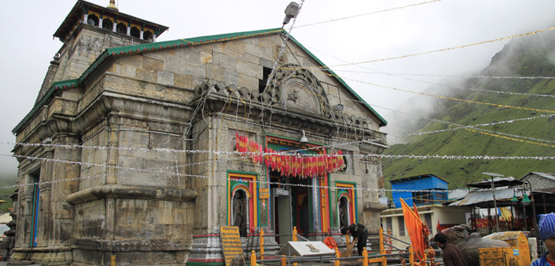
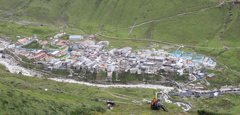
Overshadowing the most outback site, the Kedarnath town and shrine dedicated to Lord Shiva, of the Char Dham sites, the summit of Kedarnath and Kedar Dome, looming at an elevation of 6,940 meters and 6,831 meters, remains the major attraction to several wanderers around the world. Nonetheless, trekking in Kedarnath is one of the spiritual journeys that traverses through the rich alpine bed of Garhwal Himalaya dotted with varied species of Himalayan trees and leads to the abode of Lord Shiva. To the pilgrims the Kedarnath shrine, which is located on the lap of Kedarnath Mountain and on the bank of Mandakini River at an altitude of 3,583 meters, is one of the important pilgrimage sites that is frequented from the month of May to October. The vicinity surrounding the temple further pulls in several trekkers and mountaineers from different parts of the country and world.
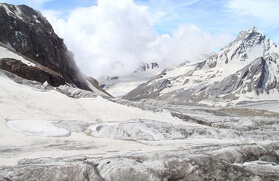
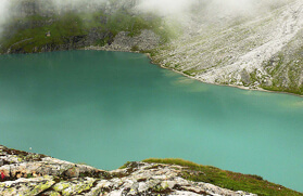
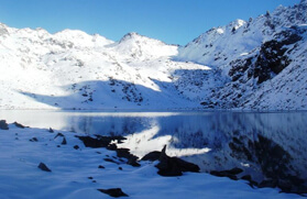
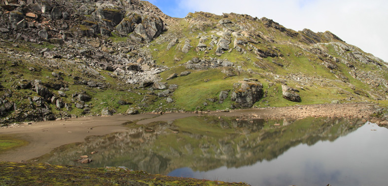
The first ascent to the Kedarnath and Kedarnath Dome was done in the year 1947 by a Swiss team and later followed by a Hungarian group in 1989. Trekking in Kedarnath further takes you deep in the Garhwal Himalaya, to Vasuki Tal, which is approximately 8 kilometers up from Kedarnath town and is situated at an altitude of 4,400 meters. Vasuki Tal is one of the high altitude lakes in the Indian Himalayan region that encircles a rugged and barren terrain and its crystal clear water reflects the peak of Chaukhamba and from its vicinity one can capture the panoramic view of the Mandakini valley. The region is also popular for Brahma Kamal, which is one of the most beautiful Himalayan flowers. Moreover, according to the Hindu myth, it is believed that at the time of Rakshabandhan, Lord Vishnu bathed in the pristine water of Vasuki Tal and hence the lake is also considered as one of the sacred lakes in the Garhwal Himalayan region.
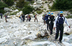
After the town suffered extensive destruction during June 2013 from flash floods caused by torrential rains in Uttarakhand state, the traditional trekking route to Kedarnath Shrine from Gaurikund via Rambara has been replaced by two alternative routes, the Chaumasi to Kedarnath route via Kham Bugyal and Reka Bugyal, and the other is Chaumasi to Kedarnath via Kham Bugyal, which is the shortest route. The approximate distance from Chaumasi to Kedarnath is 34 kilometers and it takes round about 6 to 7 hours to climb up.
Day 01:
Arrive Delhi
Day 02:
Delhi - Haridwar - Rishikesh by car (6-7h).
Day 03:
Rishikesh - Gaurikund (2000m) by car (9h).
Day 04:
Gaurikund - Kedarnath (3600m) in 6h.
Day 05:
Sightseeing in Kedarnath
Day 06:
Kedarnath - Gaurikund in 4h.
Day 07:
Gaurikund - Maggu(3050m) in 6h.
Day 08:
Maggu - Panwali Khanta(3150m) in 5h.
Day 09:
Panwali Khanta - Ghuttu (1600m) in 6h.
Day 10:
Ghuttu - Baghi Chatti (2600m) in 5h.
Day 11:
Baghi Chatti - Budakedar (1530m) in 4h.
Day 12:
Budakedar - Belak Khal (2750m) in 6h.
Day 13:
Belak Khal - Lata (1700m) in 3h - 22 Kms drive to Uttarkashi.
Day 14:
Uttarkashi - Rishikesh-155 Kms Drive to Rihikesh.
Day 15:
Rishikesh - Delhi Drive